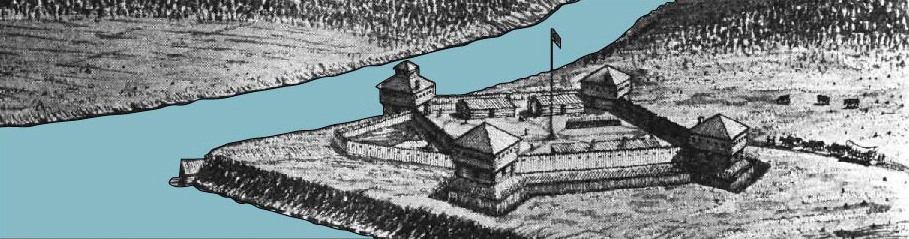
This is a 3D model that approximates the appearance of Fort Defiance in the fall of 1794. The fort has been placed on an approximation of the landscape to give a sense of space. In reality, the rivers were probably wider. I based the fort's dimensions and appearance off of primary source descriptions. Where there was no description given, such as the height of the blockhouses, I made a judgement call based upon previous forts that Wayne constructed. Although at least one drawing plan called for a ditch filled with water, there is no evidence that the ditch was ever filled. Therefore the ditch in the model remains dry. Details such as the locaiton of the corn fields and pumpkin patches are purely arbitrary. We know from numerous eye witnesses that the fields existed. They are included to add perspective.
Video
I created this model using SketchUp. Although Sketchup is not the best choice for creating accurate topographical models, it allowed me to easily create the structure of the fort itself. In order to create the terrain, I used the Sandbox feature within SketchUp that allows you to manually adjust terrain levels. In ordder to get a sense of how the terrain may have looked, I imported a map from Google that kep topographical indicators. As I expected the results were not too interesting (Ohio is pretty flat). In order to create the rivers, I overlayed a modern map of the rivers and lowered the terrain using the Sandbox tool. I then created another horizontal plain and painted it with the trasparent water option. I then adjusted the water plain to lower and raise the water level. This process allows for natural looking river edges. Finally, the video was created within SketchUp by stitching together different "scenes" that the program allows you to model.
Still Shots
All of the following images are screenshots of the 3D model shown above. Each images helps illustrate the significance of Fort Defiance.
In this image, the covered dicth that extended from the fort down to the confluence of the Muamee (right) and Auglaize (left) rivers can be seen. Safe drinking water was in short supply during Wayne's campaign. His soldiers continuosly commented on the lack of palatable water. When Wayne secured a source, he went to great lengths to ensure access to it.
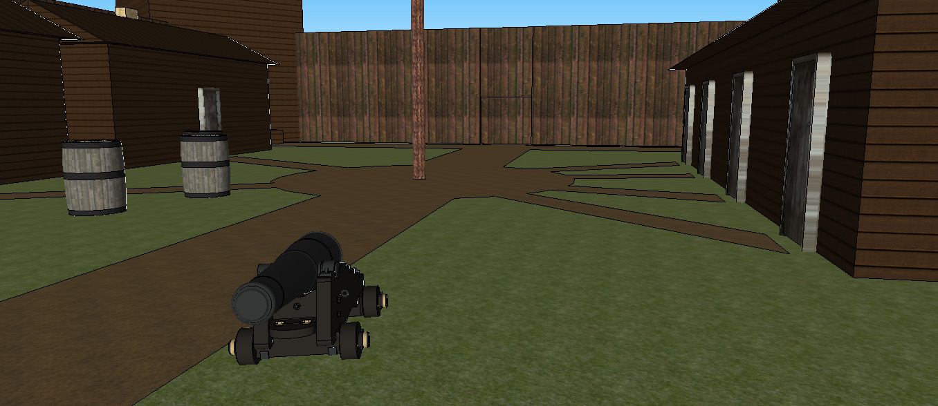
This image shows how the inside of the fort may have appeared. The inside of the fort held Wayne’s headquarters and housed other individuals of high rank. The majority of the Legion would have camped outside its walls. If under threat, these forces could then retreat to the safety of the fort.
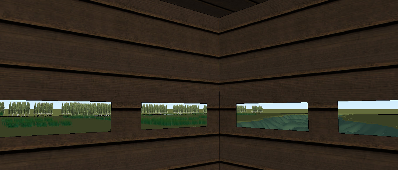
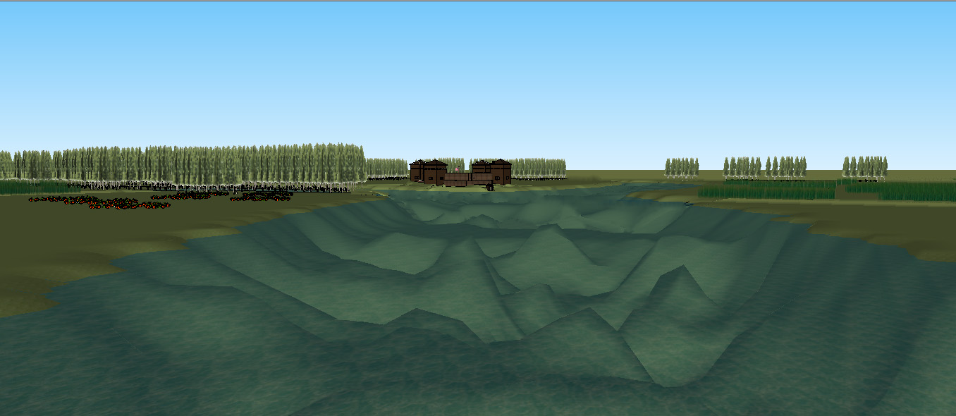
This image shows the view from the top of the blockhouse closest to the confluence of the rivers. There is no hard evidence stating that the blockhouses were two stories, but later depictions and other contemporary forts suggest that they contained a second floor. Each blockhouse also contained a fireplace with a chimney. The lower portion of the blockhouses contained cannon.
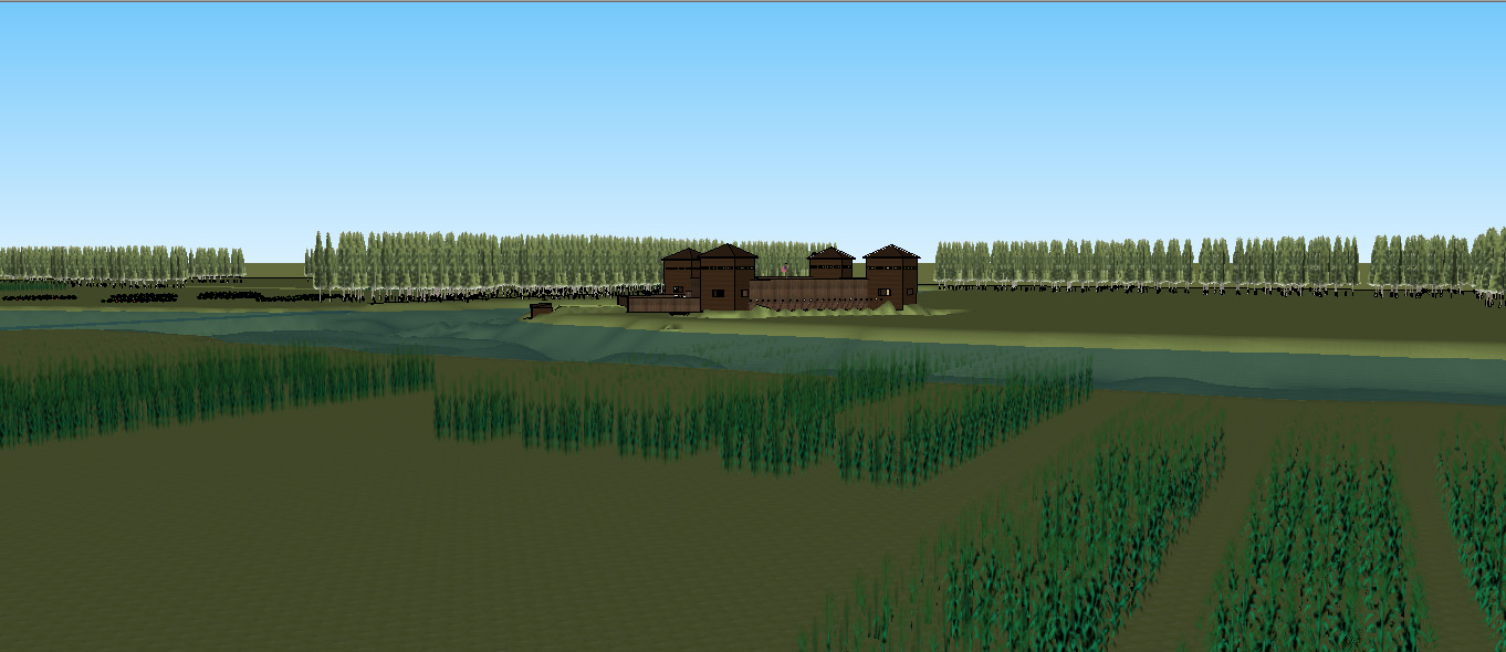
This image shows how Fort Defiance would have appeared from across the Maumee River. As the image shows, any assult upon the fort from the north or east would require the crossing of either the Maumee or Auglaize river. In the foreground the corn fields planted by the Indians can be seen. Eyewitnesses stated that these fields continued for miles along both sides of the Maumee River.
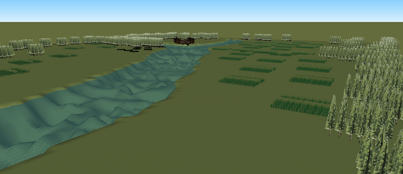
This image shows the extent of the corn fields.
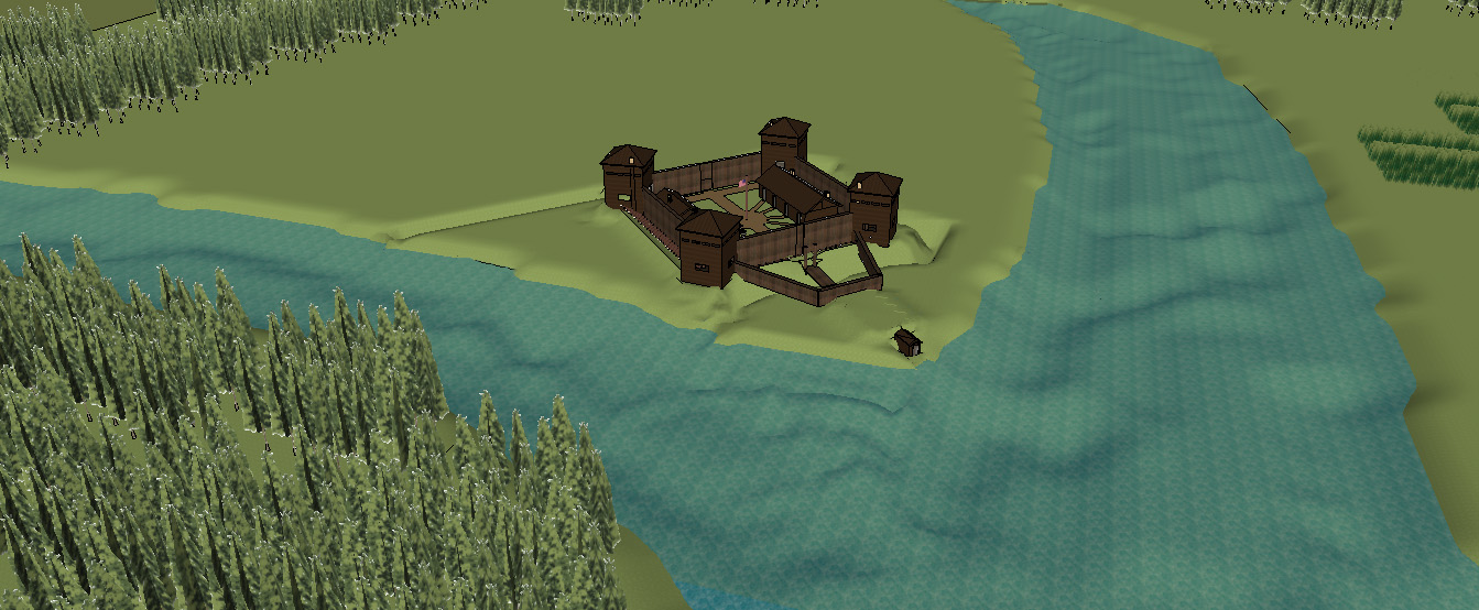
This image shows Fort Defiance and the Auglaize and Maumee rivers. From this angle, the dry ditch surrounding the fort can be seen.
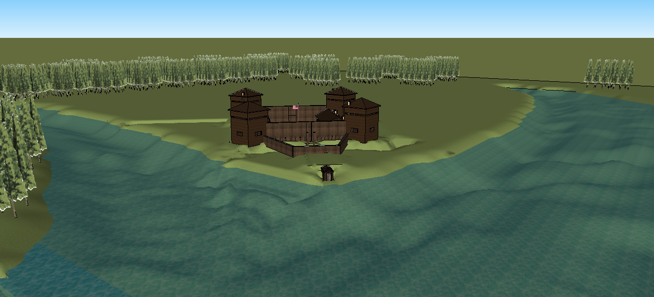
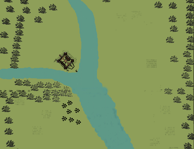
This image is an aerial view of Fort Defiance and the surrounding landscape. The Auglaize River is to the left and the Maumee River from the top of the screen to the bottom. As can be seen, any British/Indian force approaching the fort would have to cross one of the two rivers.
This image shows the fort from downstream on the Maumee River. On the left side of the image, pumpkin patches are visible.